The Simplest Guide to Lane Markings

A lot of people have asked this rather fundamental question. While driving, what is the difference between a yellow and a white line on the road? Why are some of them broken lines and some of them continuous?

Well, it’s not that difficult to understand. So here they are. With pictures.

Note: This post only aims to highlight lane markings that are along the length of the road and not the width of the road. Those along the width are easy to understand: They are basically Rumble Strips, or Pedestrian (Zebra) Crossings.

Yellow vs White

There is no concrete standard for Yellow vs White, but Yellow is used in some countries such as Mexico, the Netherlands, the United States, and Canada, the yellow line is used to separate two carriageways in an undivided dual-carriageway road. In simple terms it is used to separate traffic in different directions. In Sri Lanka, it is used for pedestrian crossings and related markings. However, they are slowly being replaced by white due to increased visibility.
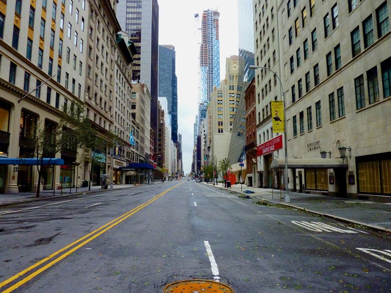
A road with Yellow and White markers in Madrid. Photo Credit: Amigos Madrid

Now, for the lines themselves.

Broken Lines

A two laned road in the Rann of Kutchh with a broken white line in the centre.
A two laned road in the Rann of Kutchh with a broken white line in the centre. Image copyright Mohammed Shafiyullah, CC-BY-SA 4.0 International, Wikimedia Commons.

A single broken line indicates that traffic can move normally on its own lane, but can cross over to the other side to overtake. In the case of dual carriageway roads, this would mean you can drive on either side of the road, and can change lanes, but with caution. On single carriageway roads, it would mean stick to your lane, the other side is for vehicles travelling in the opposite direction, but if it is empty for a significant distance, you can cross over to overtake a vehicle in front of you.

Single Solid Line
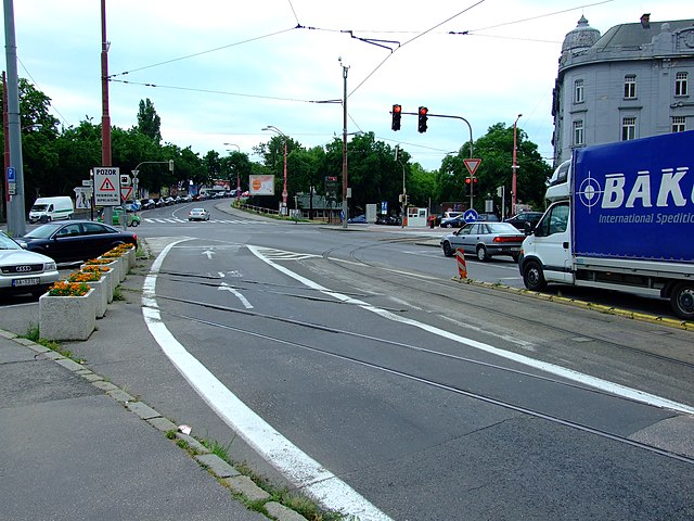
A solid white line at Šafárikovo námestie square in Bratislava near Starý most bridge.
A solid white line at Šafárikovo námestie square in Bratislava near Starý most bridge. Image copyright Aktron/Wikimedia Commons, CC-BY-SA 3.0 Unported.

A single solid line has different meanings in different countries. In India, it would mean no overtaking, or no crossing the line, except in case of a dire emergency. Turning, however is allowed, in to a lane or a gate. On single carriageway roads, it is usually found in areas where there is a sharp curve or a steep gradient, like in ghat sections. On dual carriageway roads, it is commonly found around intersections and traffic signals, thereby implying that vehicles maintain lane discipline and stay in their respective lanes while waiting at a signal.

Double Solid Line
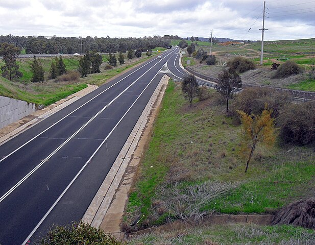
Double Sloid Lines on the Colin Knott Drive/Olympic Highway looking south bound on the Boorooma Street overpass.
Double Solid Lines on the Colin Knott Drive/Olympic Highway looking south bound on the Boorooma Street overpass. Image copyright Bidgee, CC-BY-SA-3.0 Unported/Wikimedia Commons.

Double Solid Lines are a more stringent version of single solid lines. In India, they are used where the road isn’t a proper dual carriageway road, but each carriageway is more than one lane (But less than two) wide. In simple terms, it is used on roads that are three-ish lanes wide. In Sri Lanka, it is considered on par with a solid median and attracts a heavy penalty if crossed. Vehicles cannot take a turn when a double line is there.

Single Solid + Single Broken Line
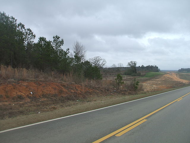
Single Solid Line and Single Broken Line on US 84 in Wayne County, MS near Tokio Frost Bridge Rd.
Single Solid Line and Single Broken Line on US 84 in Wayne County, MS near Tokio Frost Bridge Rd. Image copyright Xnatedawgx, CC-BY-SA 3.0 Unported/Wikimedia Commons.

A rather interesting combination, the Single Solid and Solid Broken line combination does exactly what the two are supposed to do as described earlier. For vehicles travelling on the side of the solid line, crossing it is not allowed, while those travelling on the side of the broken line can. It is normally found in rare stretches, mostly in areas with both a steed gradient and a sharp curve that makes maneuvering difficult in one direction but not the other.

Zig-Zag Lines

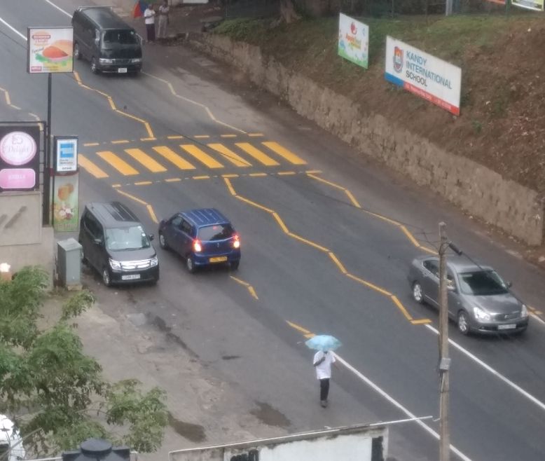
Wavy Zig Zag Lines Used Near a Pedestrian Crossing.
Wavy Zig Zag Lines Used Near a Pedestrian Crossing near St. Pauls Cathedral in England. Image copyright Benjamin D. Esham / Wikimedia Commons, CC-BY-SA-3.0 Unported.

The Wavy or Zig Zag Line, is another fascinating lane marking. Seldom seen in India, it seen across other Commonwealth Nations such as the United Kingdom or Sri Lanka. Its main purpose is to inform the motorist or driver that a Zebra Crossing or Pedestrian Crossing is coming ahead. Vehicles are generally not supposed to stop in the region with the zig-zag lines, but slow down and stop in front of the crossing itself.

Diamond Lanes

Diamond Marker on I-24 outside Nashville, TN.
Diamond Marker on I-24 outside Nashville, TN. Image copyright Goldwiser/Wikimedia Commons, CC-BY-SA 3.0 Unported.

The last and another interesting one is the diamond lane marker. Possibly never seen in India, it is commonly seen in the United States, Sri Lanka, Canada etc. Depending on where you are they have different meanings. In Sri Lanka, it is to inform the motorist of a pedestrian crossing, much ahead of the aforementioned wavy lines. In the US and Canada, it may be, among others:

  • A bicycle lane
  • A lane meant for hybrids or electric vehicles
  • A lane meant only for carpoolers
  • A lane meant for taxis
  • A lane meant for Amish Buggies

So, that pretty much explains how Lane Markings work.

Explained: The Lines and Markings on The Road, in the simplest way possible! Share on X

At the end of the day, I’d remind you of this sign from the Maharashtra State Road Development Corporation (MSRDC):
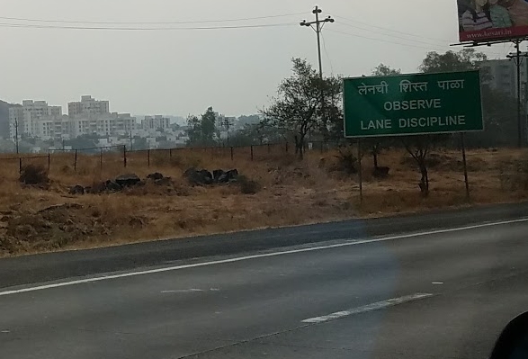
Observe Lane Discipline. लनेची शिस्त पाळा.
Observe Lane Discipline. लनेची शिस्त पाळा. Image Credit: Weird Weekends

A very special thanks to Mr. Oneil who explained the road markings in Sri Lanka to me.

Featured Image: Lane Markings at Kandy, Sri Lanka, Image: Srikanth Ramakrishnan/CC-BY-SA 4.0/Wikimedia Commons.

Save

Save

Save

Save

Save

Save

Save

Save

Save

Loading

Flattr this!

Uber Movement: Can it help us solve our Transport Problems?

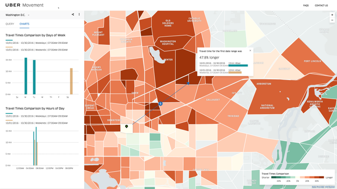
Uber recently debuted its new Platform, Uber Movement (http://movement.uber.com) which will offer users access to its traffic data.

According to Uber’s blogpost on the same, Movement is meant to be a website that uses Uber’s data to help urban planners make informed decisions about our cities.

Now this might actually work out to be the best thing to happen to us!

Let us take Mumbai and Bengaluru as an example.

Both BEST and BMTC and an eTicketing system and an ITS with a vehicle tracker in place. With these two systems, the transco is able to:

  • Place the bus on a map.
  • Compute the number of tickets sold on different stages of different bus routes.
  • Superimpose the two onto a single dataset to identify where maximum passengers are and and what time. Using this data, one can come to the conclusion of time taken between two stops, and what time people are more or most likely to catch the bus.

Now, what can Uber’s data add to this dateset:

  • Average traffic conditions. While this can be ascertained using the Vehicle Tracking in Buses as well, Uber’s data is bound to be a little more accurate.
  • Alternative routes between two points. Since Uber relies on Google Maps for its navigation, it normally is able to plot multiple routes from Point A to Point B. This data can be used to launch additional bus routes.

The purpose of a Public Transport Undertaking like BEST or BMTC using Uber Movement’s data is to provide streamlined traffic flow.

Now let us take a real-world example:

Bengaluru

Building up on a previous post (Stuck in Traffic: How I Might Have Averted a Major Jam), let us assume that one would have to travel between Arekere Gate on Bannerghatta Road and the junction of 5th Main and 17th Cross in HSR Layout. As discussed earlier, there are two main routes. Traffic data from Google, Uber and BMTC’s ticket sales would be able to place things on a map. Since BMTC does not have a smart card system in place, it would be difficult to ascertain if the passengers disembarking at Jayadeva are taking a bus towards HSR Layout. If it did have a Smart Card system, or load passes onto an RFID card, this could be ascertained easily.

BMTC can then, based on traffic movements and passenger loads, introduce minibuses between Arekere and HSR Layout via Bomanahalli during peak hours.

Mumbai

Here, let us assume that one has to travel from Cadbury Junction, Thane to SEEPZ, Andheri.

Buses have two routes. Some of them like AS-422 take the Cadbury Junction-Marathon Chowk, Mulund Check Naka, Bhandup, Powai Route. Some, take the direct route by continuing on the Easter Express Highway and taking a right turn onto the Jogeshwari Vikhroli Link Road and then proceeding on to SEEPZ. Uber Movement can help BEST figure out when there is maximum congestion, and using its dataset on how many passengers and where they travel from and to, plan a more optimal route.


At the end of the day, Uber Movement is nothing revolutionary, it is merely Google Maps with a little more data, but more data is good for all of us.

What Uber Movement will certainly help us with is planning of land acquisition for newer transit projects, wider roads, metro lines, et al. But those are capital intensive projects. Newer bus routes would be the first step to implementing a full-scale transformation project. It will help make the city’s people smart, irrespective of whether city itself is smart or not.

Loading

Flattr this!

BEST Comes Up With Three Pronged Strategy To Curb Accidents

Mumbai: BEST has devised a new three-pronged strategy to curb accidents with its fleet.

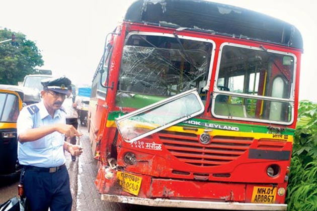
A BEST bus that was involved in an accident.
A BEST bus that was involved in an accident. Photo: News18

Among them are:

  1. CCTVs
  2. Smaller Tyres
  3. Larger Mirrors
Survey report by BEST in March 2015 . Image credits: Mid-Day

CCTVs

BEST has written to the state government to set up more CCTV cameras on streets. BEST wants to be able to monitor its drivers en route, monitor their driving skills and safety, and identify corridors where accidents are common. This should be extended to the buses too. One would wish that the requested CCTVs are for the exterior of the bus too, something which currently only the Volvo fleet has: A CCTV camera on the top of the rear window panel that can be monitored by a display next to the steering wheel.All BEST buses, barring the Volvo fleet have two CCTV cameras in them, as part of the agreement with Verve Compusoft for the PIS and Advertising system. However, BEST themselves are unsure as to how many of them are functional, and like the PIS, it is also in bad shape and nothing can be done due to a badly enforced contract. While more CCTVs is one thing, whether they will be properly utilised, is another thing.

Smaller Tyres

BEST has decided to get smaller tyres for its buses, as a alternative to installing a speed governor. While this might be great for certain routes, care must be taken and larger tyres must be present on buses that ply on Express or Long Distance routes such as A74Express or A8Express which ply on the Bandra-Worli Sea Link and the Eastern Freeway as well as go on top of almost every flyover on the Western and Easter Express Highways respectively.

6,500 new tyres will be fitted in 775 Tata buses (out of the total 3,800 buses that BEST has) and will be procured at a cost of ₹4.72 crore. The older nylon tyres are 9.00 x 20-14PR while the newer nylon tyres will be 9.00 x20-16PR.

Speed Governors are mandatory on heavy vehicles like buses, trucks and trailers under the Central Motor Vehicle Rules of 1989.

Mirrors

The Undertaking will also install newer mirrors. The new mirrors, with a dimension of 380mm x 190 mm is being tested. The existing mirrors are 40% smaller. If they are found to be useful, it will be retrofitted into 303 new buses and then gradually into the rest of the fleet as well.

Overall, BEST seems to have done a great deal of study to reduce accidents. We wish them all the BEST (pun intended) and hope they succeed.


Save

Save

Save

Save

Save

Save

Save

Loading

Flattr this!

The Amish Buggy is High-Tech, Why Can’t Our Victoria’s Be The Same?

I recently came across a very interesting article on Popular Mechanics about the Amish Buggy. The Amish (not Tripathi) are a group of traditionalist Christians who practically reject the use of electricity, telecommunications and automobiles. They use a traditional Horse and Buggy to travel.

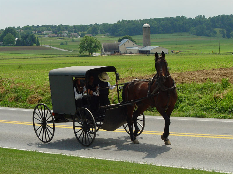
Amish family riding in a traditional Amish buggy in Lancaster County, Pennsylvania, USA.
Amish family riding in a traditional Amish buggy in Lancaster County, Pennsylvania, USA. Image copyright TheCadExpert, CC-BY-SA 3.0 Unported, available on the Commons.

Why can’t our Victoria carriages be similar?

The article: The Amish Horse-Drawn Buggy Is More Tech-Forward Than You Think

The Amish Buggy has the following “high-tech” components:

Brakes

The Amish Buggy uses drum or disk brakes, that are similar to modern automobiles but not powered. There is a brake pedal that is connected to this, mainly to prevent the buggy from hitting the horse.

Electrical Components

Since states such as Ohio and Pennsylvania require vehicles to have lights, some buggies come with a dashboard of switches for brake lights, external lights, headlamps, turn indicators, et al, most of which are LEDs. They use a 20V/6A battery that usually powers an electric drill. Back home in India, nobody gives two hoots about lights and indicators.

The Body

The Body of the buggy is quite interesting. These days, they’re made of fibreglass. Yes, that’s right, fibreglass. Aluminium components are also used, while the whole thing is coating with white oak or ash wood with fabric and polyester donning the upholstery.

Modern buggies also use Thermally Modified Wood, which is basially wood that is dried up and then “baked” to take the moisture completely out of it. This gives it a long life and makes it difficult to rot.

Tyres and Wheels

The buggies normally use either Steel or Solid Rubber tyres, with Steel being preferred since it isn’t compressible like rubber which is quieter. Those with Rubber tyres, have rear mounted brakes while those with Steel tyres have front mounted brakes. The wheel is made of Steel, Wood, Aluminium or Fibreglass.

Yes, the Amish Buggy is quite an interesting thing, although it might seem silly to abstain from modern technology. I’d like to ride on one some day, but one only hopes that the Victorias in Bombay made some similar modifications. It would certainly spruce them up, even if they are being banned.


Save

Save

Save

Save

Save

Loading

Flattr this!

Dindoshi To Get A Makeover

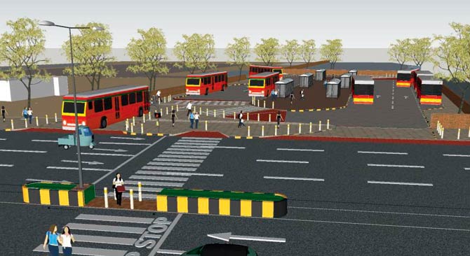
The Dindoshi Bus Station (next to the Dindoshi Depot) on the Goregaon-Mulund Link Road near Oberoi Mall is all set to get a facelift.

Dindoshi Depot Render by WRI India

Below is a slideshow on the whole subject:

In the above slideshow, a lot of emphasis is laid as to why Dindoshi was chosen for this. Dindoshi Bus Station is among the busiest bus stations in Mumbai. The plan takes into account the number of buses entering and leaving, the different routes along with the existing facilities at the bus station. The depot and terminal occupy 3242.9 sqm., and witnesses approximately 8331 passengers a day.

The existing terminal has a terminal building, bus bays, bus parking bays and a passenger boarding area. For pedestrians, it is a bit dangerous due to the large gap in the central median outside the depot as well as vendors on pedestrian pavements. It is a little difficult to spot as well, due to its inconspicuous look. Further, due to a single entry point for drivers and buses, it is accident prone. Passengers further have to often board buses in the parking bay, thus making them walk across the open area of the terminal where buses are in motion. Due to haphazard parking, buses may also collide with each other.

Several changes have been proposed to the layout, in two phases:

Phase One

Phase One lists the basic changes that need to be made:

  • Improving pedestrian safety while accessing the terminal
  • Changing bus circulation and the pattern in the terminal
  • Reorganising the terminal layout for better accessibility and safety
  • Amenities for both passengers and staff

Phase Two

Phase Two involves commercialising the entire structure.

Multiple concepts have been provided in the entire plan, which can be seen in the Slideshow.


Overall, this is a good move. If it is done in the right way, with proper accessibility for pedestrians and those who are visually or physically impaired, it would be a big boon for the city and for BEST.


Save

Save

Save

Save

Loading

Flattr this!

Amphibious Bus, Water Bus, Boat Bus?

Meet the Boat-Bus! Yes. Or atleast that’s what they’re calling it.

Two separate Boat-Buses made their appearance in the last two months, one in Punjab and one in Lucknow. Both are the exact opposites of each other.

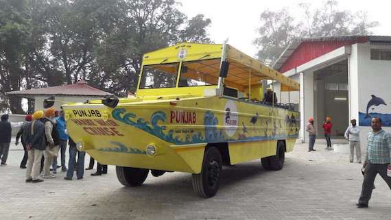
Presenting The Harike, Punjab’s Boat-Bus for tourists in the Harike wetlands.

The Harike Water Bus. Image via Twitter.

At first glance, anyone who sees this picture will say: “Wait, what? That looks like a Banana on Wheels!”.

Personally, I’m confused whether it is a boat with wheels or a mini-van shaped like a boat. Functionally, it is both. There is a ramp that leads it into the water from where it functions as a boat. Something like a Hovercraft, one might say.

While Aesthetics seem to have taken a backseat here, it is functional enough. One just hopes that it does not capsize in the water.

Now, presenting Lucknow’s Water-Bus.

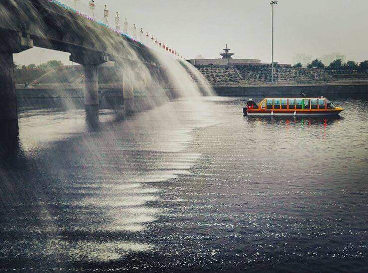
Lucknow Water Bus. Image via Facebook.

It’s a boat. Yes. A covered boat. Lucknow, by virtue of being on the banks of the Gomti river has managed to get a functional water transport system due to start commercial operations by this month.

What confuses me is where there is so much water in Gomti river and why is there so much water pouring down from the bridge? Are they filling the river? I know this is possible in Ahmedabad because the Sabarmati is designed like a giant drain, but does Uttar Pradesh have the wherewithall for such a thing?

It would be nice to someday see the Yamuna, Ganga, and Kaveri be cleaned up. Cities like Delhi, Kanpur, Varanasi, Erode and Thiruchchirapalli (Trichy) too can then set up their own water transport systems.

As I had outlined in a previous post, on the basis of Pune and Ahmedabad, any Indian city that lies on the banks of a major river can get itself a good water transport system. Further, cities on the coast, mainly Mumbai, Chennai, Visakhapatnam (Vizag), Panaji, Mormugao, and Mangalore should get hovercrafts. Water transport is slowly getting more prominence in the country. Mumbai is getting a terminal for water-based Ro-Ro transport. Rolling Highways are one thing, but Floating Highways? Why not. If we can have a Konkan Railway, why not a Konkan Waterway.

It’s high time, we start innovating and looking at newer modes of transport. The Hyperloop concept is still eons away. Till then, let us focus on more terrestrial transport, which doesn’t necessarily have to be on land. As they say, Water is the Basis of Life.

The Boat-Bus can form a crucial part of a Floating Highway network. Share on X

Save

Loading

Flattr this!