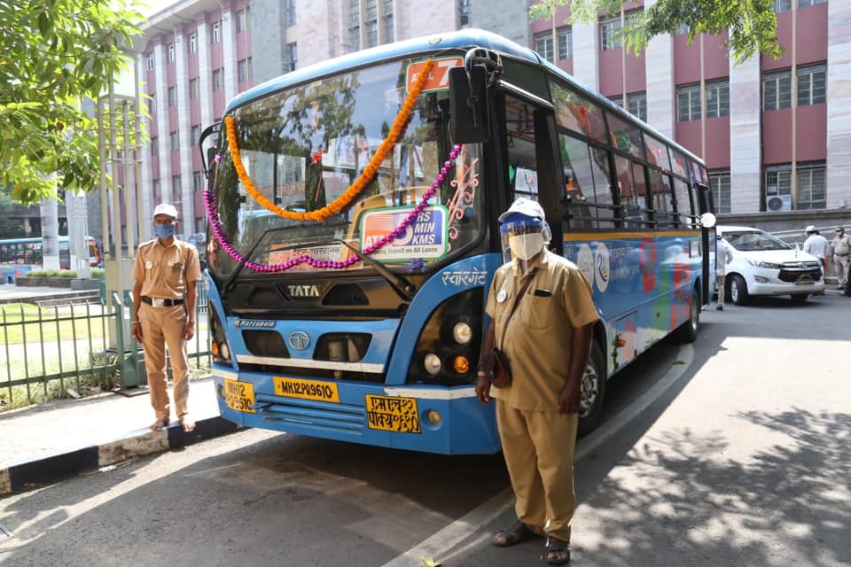
In what can only be considered a big boost for public transport, clean air and people’s pockets, the Cabinet approved the PM e-Bus Sewa on 16 August 2023.
Under this scheme, the Centre plans to deploy 10,000 electric buses across the country. According to the release on the Press Information Bureau, the buses will be deployed under the public-private partnership (PPP) model across 169 cities while the infrastructure will be upgraded in 181 cities under Green Urban Mobility Initiatives (GUMI). The estimated cost of the PM e-Bus Sewa is expected to be ₹57,613 crore and is expected to generate over 45,000 direct jobs.
All cities with a population above three lakh (as per the 2011 census) along with the capital cities of Union Territories, Northeastern region and the hill states will be covered with priority being given to those cities that currently do not have an organised bus service.
The programme is divided into two segments:
Segment A involves augmenting city bus services in 169 cities along with providing support for the associated infrastructure, upgradation of depots, establishment of substations, etc.
Segment B will cover GUMI across 181 cities. Here, initiatives such as bus priority, multimodal transit, NCMC-based payment systems, and charging infrastructure will be provided.
States, cities and the parastatals will be responsible for making payments to the private operators while the Centre will provide subsidies to the extent provided under the scheme.
This scheme is great news for India as it will impact not just public transport, but a lot of things. For starters, it will give a huge fillip to the manufacturing and the supply-chain ecosystem of buses, their components, and behind-the-meter infrastructure. The increased availability of buses will also change how people perceive commuting and how they actually commute.
One good news that merged right away was Volvo’s entry into the electric bus segment in India. Volvo India stated that it would consider entering the sector under either the Volvo or Eicher brand.
While the government has done a lot in improving the electricity supply system with an increase in renewable energy including solar, wind and even hydel power, it needs to scale up on nuclear power.
The shift from the Jawaharlal Nehru National Urban Renewal Mission (JnNURM, with a jurm of a logo) to the Atal Mission for Rejuvenation and Urban Transformation (AMRUT) to Faster Adoption and Manufacturing of (Hybrid &) Electric Vehicles in India (FAME) to now PM e-Bus Sewa has been quite fantastic.
With the impending opening up of the Vandalur Kilambakkam Bus Terminus in southern Chennai, one fear among many of the city’s residents is not going away. The Chennai Metropolitan Development Authority (CMDA) has proposed to shut down the Chennai Mofussil Bus Terminus (CMBT) (also known as Puratchi Thalaivar Dr MGR Bus Terminus or MGR Koyambedu) permanently.
A little background
Broadway Bus Terminus. Photo Credit: Commercial Vehicles Magazine
Opened in 2002, CMBT is a 37-acre bus station that serves as Chennai’s primary terminus for mofussil and long distance buses operated by various government agencies. It is owned by the CMDA and operated jointly by the six divisions of the Tamil Nadu State Transport Corporation (TNSTC), namely TNSTC Villupuram, TNSTC Coimbatore, TNSTC Salem, TNSTC Kumbakonam, TNSTC Tirunelveli and TNSTC Madurai. The remaining two arms of the TNSTC, the Metropolitan Transport Corporation (MTC) and the State Express Transport Corporation (SETC) also play a role in the daily operations.
Prior to 2002, Chennai had no dedicated bus station for long-distance buses. Few SETC buses usually operated out of one half of the Broadway bus terminus. Other SETC and nearby states’ buses would operate out of a vacant plot of land opposite Chennai Fort railway station, which today houses the Government Dental College and Hospital while private buses would operate from the Gandhi-Irvin Bridge Road near Chennai Egmore railway station on the banks of the Cooum river.
In the late 1990s, the wholesale market located at Kothawal Chavadi was moved to a 295 acre plot in Koyambedu. After this, the entire operations of all government buses was shifted to the new bus terminus at CMBT. A separate 6.7 acre bus station was built across the road, adjacent to the whole market. Named the Chennai Contract Carriage Bus Terminus (CCCBT), it handles between 350 to 450 private buses and 5,000 passengers a day.
Till 2018, CMBT was the hub for all TNSTC and SETC buses, as well as buses operated by the RTCs of Puducherry (PRTC), Karnataka (KSRTC), Kerala (also KSRTC), Andhra Pradesh (APSRTC), and Telangana (TSRTC). In 2018, TNSTC buses bound for Telangana and Andhra Pradesh, as well as APSRTC and TSRTC buses were shifted out to Madhavaram Mofussil Bus Terminus (MMBT).
Madhavaram has its problems
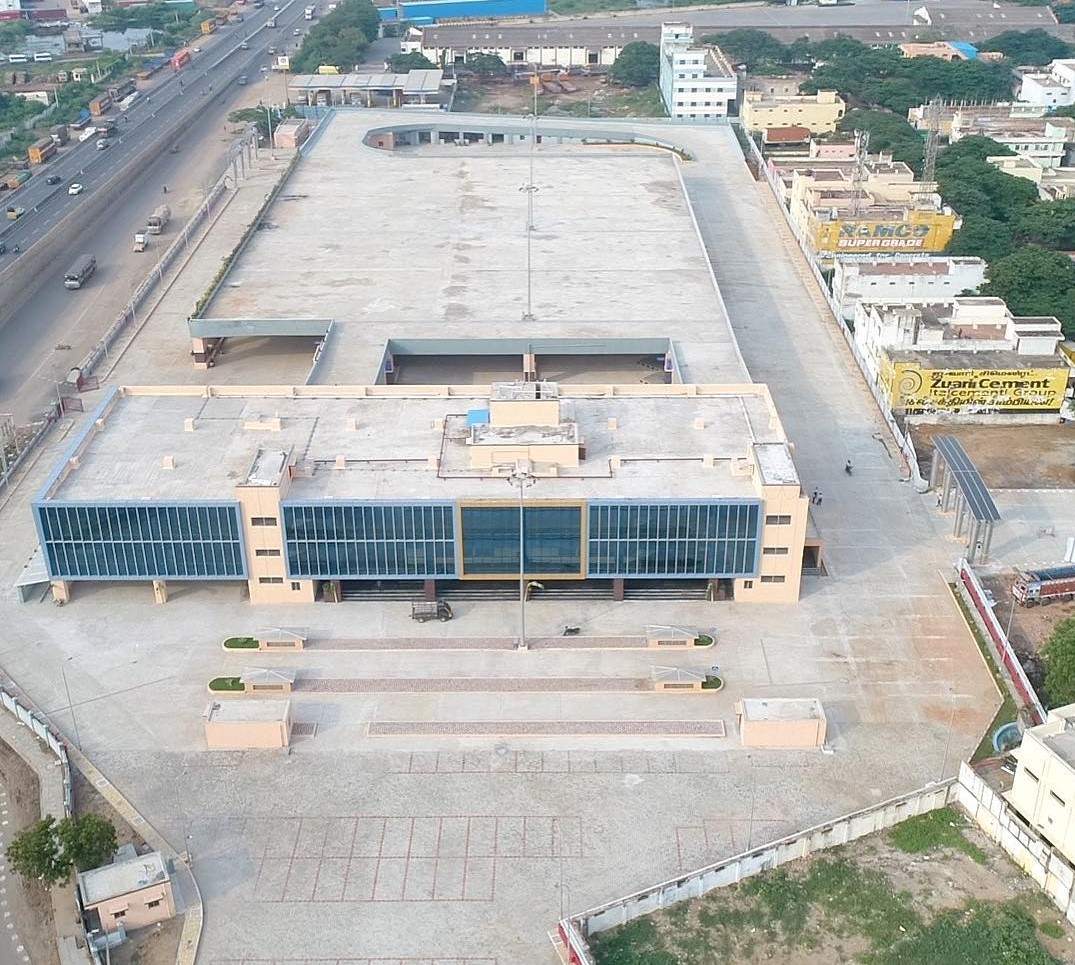
Madhavaram Mofussil Bus Terminus (MMBT). Photo Credits: BNR Infrastructure
MMBT is an 8 acre, two-level bus terminus located at Madhavaram, adjacent to CMDA’s truck terminal, at the intersection of Grand Northern Trunk Road (GNT Road) that forms National Highway 16 (formerly NH5) and Inner Ring Road (IRR/State Highway 2). While it does feature two platforms for MTC buses, it otherwise lacks good connectivity. There are a few buses that connect it to CMBT and a lot of buses that connect it to Broadway or Vallalar Nagar (V Nagar/Mint Street). Passengers arriving from CMBT have to cross the road at the roundabout which witnesses heavy truck traffic. While MMBT and CMBT are located barely 10km apart, it can take up to 30-40 minutes to reach there.
Around 315 buses use the terminus daily, catering to an average of 12,000 passengers, with a higher number over the weekends. While TNSTC and APSRTC operate numerous services to Andhra Pradesh, TSRTC operates one Volvo service to Hyderabad. APSRTC operates several buses to Vijayawada. There are no buses to Visakhapatnam or Yanam and SETC doesn’t operate a single bus into either Telugu-speaking state. In fact the destination with the highest number of SETC routes apart from Chennai is Bangalore.
MMBT can handle 42 buses on the ground level and another 50 from the upper level. However, only government buses currently operate from MMBT while private buses continue to operate from CCCBT. This puts the former, especially APSRTC buses at a major disadvantage. Interestingly, some of TNSTC’s buses bound to Tirupati start from CMBT, which also gives it an unfair advantage over its Andhra Pradesh counterpart.
Connectivity to Madhavaram will eventually improve drastically. The under-construction lines 3 and 5 of the Chennai Metro both start at Madhavaram Milk Colony, located to the northeast of MMBT with Line 5 have a station outside MMBT. It will further continue on IRR and meet the Green Line at Koyambedu (not CMBT) and then at Alandur before meeting the MRTS at St Thomas Mount/Parangimalai. While the Chennai Metro Rail Limited (CMRL) expects all three lines of Phase 2 to be completed by 2025, our friend TheMetroRailGuyestimates it to be completed no sooner than 2028.
Now coming to Vandalur Kilambakkam
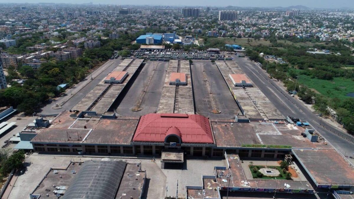
While CMBT is currently Asia’s largest bus terminus at 37 acres, it will be soon dwarfed by the Vandalur Kilambakkam bus terminus that is spread across a whopping 88.5 acres. A timely reminder here that Delhi’s Millenium Park is not a bus station but a depot and therefore not Asia’s largest bus station.
With a total built-up area of 6.4 lakh square feet, it will feature 215 bus bays of which 130 will be for government buses and 85 will serve private buses. It will also have parking space for 300 buses, 275 cars and over 3,500 two-wheelers. An MTC terminal is being built adjacent to it, spread over 7.4 acres, nearly the area of MMBT. Interestingly the entire bus terminus lies within a protected and prohibited zone of the Archeological Survey of India (ASI) as it contains Megalith Burial Sites. The National Monument Authority (NMA) gave a green signal so long as no commercial development took place for 100m in the region except for greenery and the CMDA installed the required signage.
By road, the distance between CMBT and Kilambakkam is exactly 30km if one were to take IRR till Kathipara and then continue onto Grand Southern Trunk Road (GST Road). The distance is the same if one were to go to Maduravoyal and take the Chennai Bypass till Irumbuliyur and then proceed along GST Road. Outer Ring Road (ORR) terminates on GST Road just north of the bus station. The nearest railway stations are Vandalur and Urapakkam on the Southern Line of the suburban railway, both of which are at least 10 minutes away. As for Metro, the nearest station is Chennai International Airport, located 16km away. After a long tussle between the Highways Department and CMRL, an extension of the Blue Line from Airport to Kilambakkam is on the map. The former wanted to build an elevated corridor on the route and the metro’s height will be decided accordingly. However, this will take several years to reach fruition and till then there will be heavy traffic. CMRL has also initiated feasibility studies to extend Line 3 (Madhavaram Milk Colony to Siruseri) to Kilambakkam via Kelambakkam (Get ready for more confusion). However this is light years away since the depot is at Madhavaram and most of the line runs underground and without a depot connection, nothing can happen.
One theory that I have heard is that private players would lobby the government to let them continue operating at CCCBT. This would put all TNSTC services at an unfair disadvantage and would hurt the poorer sections of society the most. Further, GST Road is the most congested highway in Chennai since it acts as a gateway to the entire south from Coimbatore to Madurai to Trichy to Tirunelveli and Nagarcoil. The time saved by buses in exiting the city will be lost in reaching the terminus. Auto and cab fares will end up costing the same as an intercity luxury bus ticket while bus journeys with luggage in MTC buses would be unbearable.
The worst hit would be commuters towards the West: Those heading to Vellore, Bangalore, Hosur, Krishnagiri, Dharmapuri and even Salem, Erode and Coimbatore. Passengers living in North Chennai will also be affected badly. The bus journey from Bangalore which takes approximately six hours from Shantinagar to CMBT will go up by at least an hour and then there is the extra hour lost in getting to Chennai city itself.
Note: Bangalore-bound passengers won’t have to travel to Kilambakam at all. But it’s worse. Read the update section at the bottom of the post please.
The way ahead
The way ahead for CMBT isn’t all that difficult. It currently has connectivity to most parts of Chennai thru MTC buses, has a metro connection to both the major railheads (MGR Chennai Central and Chennai Egmore) and the airport.
Among the various proposals for the land, the most ridiculous one is to build a park. While I won’t deny that parks are important, the city is home to 632 parks as of 2019. The city’s per capita green cover stands at 8.5 square metres, just short of WHO recommendation of 9 square metres. In 2019, the began an ambitious plan to set up 67 new parks, mainly due to the destruction of close to one lakh trees in 2016 due to Cyclone Vardah.
CMBT can remain a bus terminus, albeit with some redevelopment. CMRL is in the process of redeveloping Broadway as a multi-storey bus terminal. MTC has been toying with this idea for the Thyagaraya Nagar (T Nagar) bus terminus for years now. CMBT could easily be redeveloped with a bus station at the ground level, parking and commercial operations above that. Bangalore has successfully done this. The Shantinagar bus depot was converted into a bus terminus with a Big Bazar and a parking lot atop the bus station back in the early 2000s. In fact, even the Kalasipalayam bus terminus, used mostly by private buses has been redeveloped in such a fashion. With bus and metro connectivity, the land will be premium, and give the CMDA a significant return on investment that can be used elsewhere.
There is no requirement for CMBT to shut down. Broadway didn’t shut down when CMBT opened up and in fact some SETC buses for Madurai still depart from Broadway. Many cities operate with multiple bus terminals. Mumbai has five outstation bus terminals while Pune has three. Bangalore has three and its central bus station, the Kempegowda Bus Station at Majestic was briefly downsized for metro construction. In the interim, certain buses were moved to Shantinagar and Mysore Road Satellite Bus Station at Bapujinagar. Today all three operate successfully.
But perhaps the most radical of all ideas came from a friend on Twitter, Krishnan. He tweeted that the site could be used for a future High Speed Rail terminal, and I could not agree any more. Given that the first HSR line to Chennai will connect it to Bangalore, it makes sense to keep the terminal somewhere near Poonamalle High Road/Grand Western Trunk Road (GWT Road). Given CMBT’s nature as the city’s pre-eminent transport hub, it makes perfect sense to make CMBT the HSR terminal as well. It will aid in quick commutes, fast transfers between different modes of transport, and will not hurt passengers’ wallets or watches.
Update
It’s 2024 and Kilambakkam (now nammed Kalaignar Centenary Bus Terminal or KCBT) is operational. While I haven’t been there, things aren’t smooth. MTC buses bound for KCBT are taking a minimum of an hour to reach there from Velachery. One good thing is 21G (Broadway to Vandalur Zoo) has been extended to KCBT, especially the AC bus but there are no AC buses from CMBT.
Private buses have refused to ply from KCBT and CMDA and the transport department has threatened to file criminal cases against them. Some buses were even forced to run empty from CMBT to KCBT. You can read more here. Southern Railways meanwhile has begun work on a new station which will take time to complete. On this note, do read: Urban Connectivity Chaos: People Managing Metro, Railway, Bus Stations Are Working In Silos by Srikanth Ramakrishnan on Swarajya.
For Bangalore and other West-bound passengers. It seems the powers that are have decided to make things worse for us. We will have to depart from another bus terminus, this time at Kuthambakkam near Thirumazhisai. This 25-acre bus terminus is touted to be completely air-conditioned and will feature a food court. The downside? It’s worse located than KCBT. It is approximately 9km from the Poonamalle junction and 2.5km from the highway. Getting there will obviously be a mess. It will feature 136 bus bays and CMDA is in the process of identifying access roads to be built. The Chennai Unified Metropolitan Transport Authority (CUMTA) has asked for an extension of the metro to start work. This line, connecting Poonamalle too Light House is under construction and connects with the existing network at Vadapalani.
Let us pray that the administration does not miss this opportunity.
Featured Image: Chennai Mofussil Bus Station (Seshadri Sukumar/PIB Chennai)
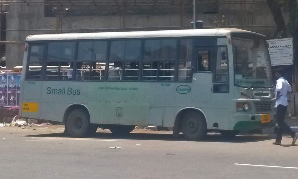
In what can only be deemed a major embarrassment for the Metropolitan Transport Corporation (MTC) of Chennai, crewmembers belonging to the Chromepet Depot (CR/CW) were found to have disconnected the vehicle tracking devices and skipping interior regions in mini-bus routes. These buses, operating as “Small Bus” are generally operated as feeder services from metro, railway and bus stations to interior regions where the patronage is low.
According to a report in the Times of India, the issue came to light when residents of Chitlapakkam were unable to track the bus S100 that runs from Tambaaram to Chennai International Airport Metro Station. In May 2022, transport minister SS Sivashankar had launched the Chennai Busapp, developed in partnership with Chalo. MTC staff were reported to have disconnected the tracking devices in their bus and then skipped some regions altogether, thus leading to long waiting times. Officials of both the MTC and the Chennai Metro Rail Limited (CMRL) warned the staff and even deputed officials on the buses to ensure that they did not skip any stops or routes.
This brings about an important question. What are we to do when services are being sabotaged by the staff themselves? A general warning is not good enough. There has to be serious consequences. A lack of pay or suspension without pay or even termination of employment would ideally make the best sense. At the end of the day, public transport is largely non-profitable and is funded by taxpayer money.
On another note, since MTC has brought back AC buses after a long time, maybe MTC could consider running AC mini-buses on certain routes, especially feeders for the metro.
Featured Image: MTC Small bus on Route S35 from Ashok Pillar/Ashok Nagar Metro Station to Defence Colony (Ekkattuthangal). Photo clicked in 2014 by Srikanth Ramakrishnan, available on the Wikimedia Commons.
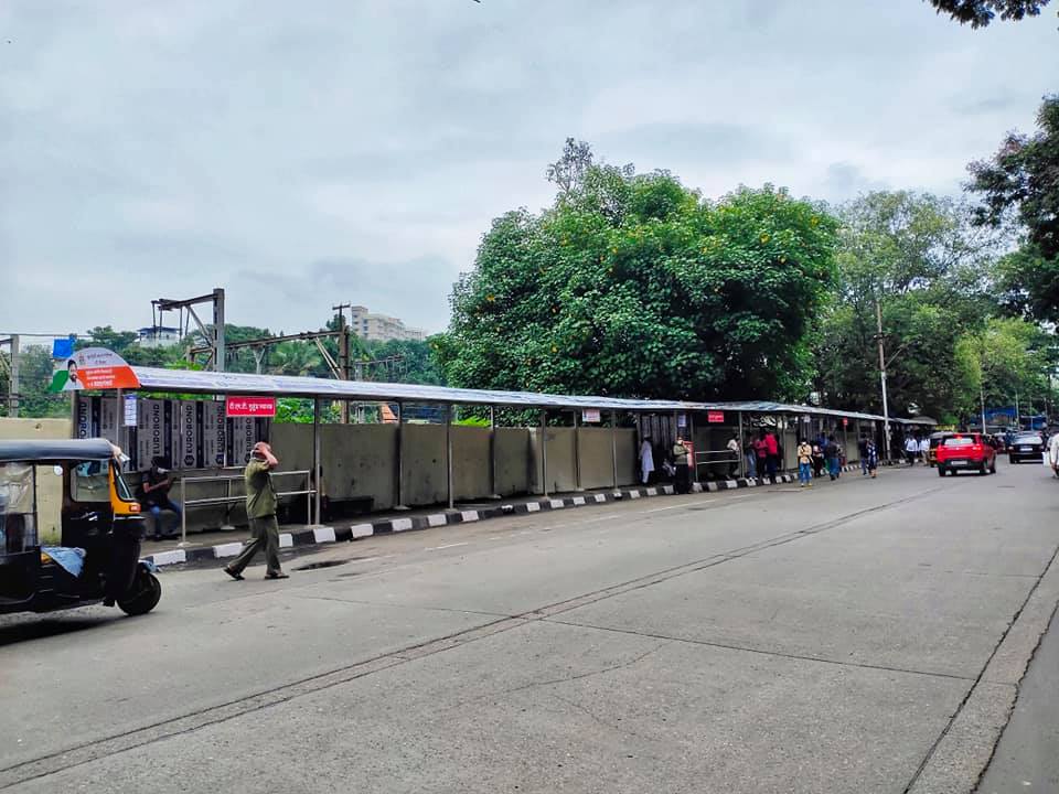
In what seems to be a welcome break from the constant rivalry between different municipal transport bodies within the Mumbai Metropolitan Region (MMR), the Birhanmumbai Electricity Supply and Transport (BEST) undertaking and the Thane Municipal Transport (TMT) undertaking have set up a combined bus shelter for both their buses at Mulund Station.
While the rivalry between BEST and TMT was predominantly along the coveted Thane-Borivali Route (AS-700 and AC-65), it eventually expanded to other routes including non-AC ones as well. Thankfully, it never went as bad as the relationship between BEST and the Navi Mumbai Municipal Transport (NMMT) undertaking went when in 2010, NMMT refused entry to BEST’s AS-505 to its bus station at CBD Belapur while BEST refused entry to AC-125 at Santacruz and Bandra Bus Station.
While BEST and TMT (also NMMT) buses do enter each others’ bus stations and halt at each others’ bus stops, they are always clearly demarcated. For example, at Agarkar Chowk, TMT buses stop at a unipole marked with TMT’s routes, similarly on the Thane Belapur Road, bus shelters will see a separate unipole for BEST buses.
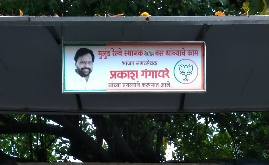
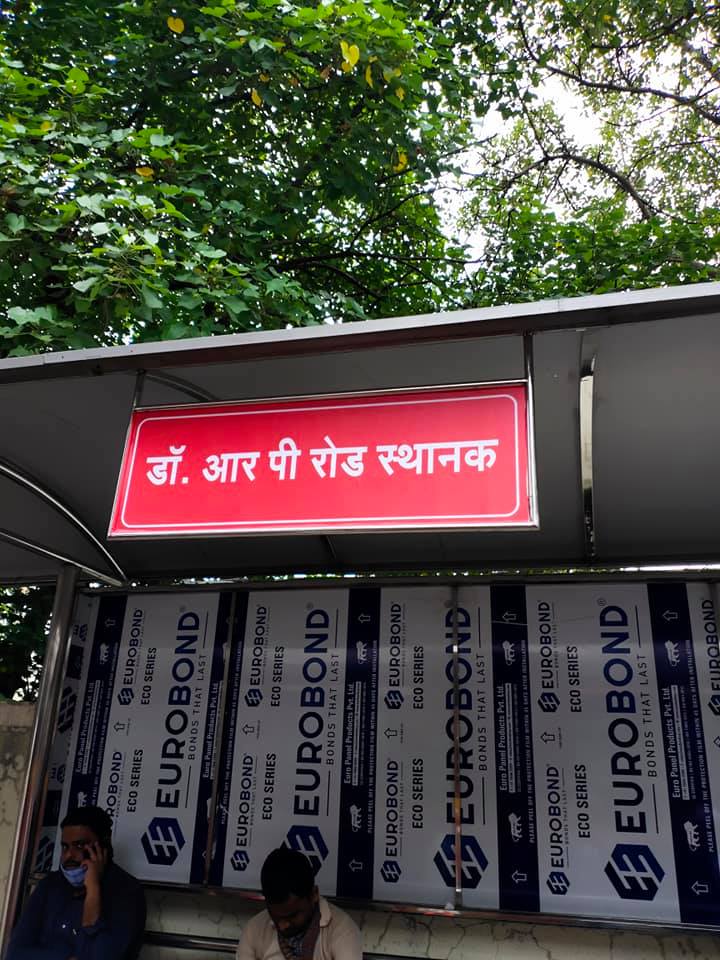
The bus stop at Mulund is an initiative of the local corporator Prakash Gangadhare of the Bharatiya Janata Party, representing Ward No 104 of the T-Ward in the Municipal Corporation of Greater Mumbai (MCGM) who is also a member of the BEST committee. It was built by combining three existing bus stops –Dr Rajendra Prasad Road and Sardar Vallabhai Patel Road and Mulund Railway Station (West) and is located at Jata Shankar Dosa Road (JSD Road). The earlier TMT bus stops have been demolished by the MCGM.
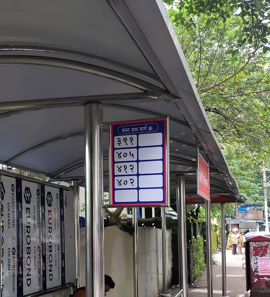
BEST buses that earlier stopped at Dr Rajendra Prasad Road include the following: 303, 396 Ltd, 398 Ltd, 422, 424, 460 Ltd, C-16 Exp. BEST feeder buses that earlier stopped at Sardar Patel Road include the following: 391, A-402, A405, A412. TMT buses that stopped nearby earlier include: 85, 88, 102, 104, 110, 115, 122.
Fellow transit fan and BEST enthusiast Vishal Naik took some photographs of the bus stop. Another BEST enthusiast, Rupak Dhakate pointed out that the bus stops should be segregated since they would cause confusion between BEST and TMT users. He also pointed out that the current route signage did not differentiate bus routes based on the colour coding that BEST uses – black for regular, red for limited, blue for air-conditioned and green for express routes – another potential situation that may cause confusion.
Below are some pictures of the bus stop, clicked by Vishal Naik.
The new bus stop when viewed across the street (Vishal Naik)A unipole marking BEST buses that stop at this bus stop. Note that all of these buses are AC routes, and thus should have an A prefixed to them, which they don’t. (Vishal Naik)A name board marking the bus stop as Dr Rajendra Prasad Road (Dr R. P Road) (Vishal Naik)A name board marking the bus stop as Sadar Vallabhai Patel Road (S. V. P Road) (Vishal Naik)
Of course, there is a small problem. Apart from the congestion issues that Rupak mentioned earlier, there is also the issue of auto-rickshaws.
When BEST launched its AC mini-buses in Andheri in late 2019, auto-rickshaws cried foul as they quickly lost patrons. In the case of Mulund, it seems the auto-rickshaw fleet pre-empted that and decided that they’d park right in front of the new bus stop. Looks like the Mumbai Traffic Police have a task on their hands.
Auto-rickshaws waiting to pick up passengers right outside the new bus stop (Gandharva Purohit)
Let’s hope this bus stop does well for both BEST and TMT!
Featured Image: Photo of Prakash Gangadhare at the new bus stop (Gandharva Purohit)
Do follow Rupak on Twitter (slzrupak) and Instagram (@mlv.rupak). Do follow Vishal on Twitter (@vnaik23) and Instagram (@not_huge). Do follow Gandharva on Twitter (@gp30543).
If you intend to step out please wear a mask, carry sanitizer and maintain social distancing.
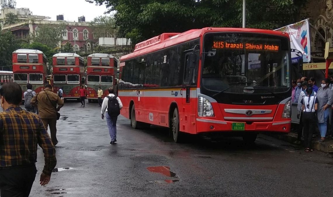
Nearly four years after it got is first batch of electric buses (Goldstone non-AC buses at the Backbay Depot), the Brihanmumbai Electricity Supply and Transport (BEST) undertaking last week (7 August, BEST Divas), rolled out its latest buses. Full length, electric, air-conditioned buses are finally here as part of the fleet.
BEST has been experimenting with several buses over the last four years, particularly in the air-conditioned fleet. Today the fleet consists of Tata Starbus Diesel-Hybrid full-length buses, Force Smart Citibus Diesel mini-buses, Tata Marcopolo CNG midi-buses, Tata Ultra Electric Midi-buses, Olectra electric Midi-buses and now Tata Ultra Electric full-length buses.
The new lot of buses will be attached to the Backbay Depot in South Bombay and Dharavi Depot in mid-town. Two buses were flagged off on 6th August. The routes are A-115 from Chhatrapati Shivaji Maharaj Terminus to NCPA via Churchgate and A-116 from Chhatrapati Shivaji Maharaj Terminus to NCPA via the Reserve Bank of India and Museum (Dr Shyamaprasad Mookherjee Chowk).
@CMOMaharashtra flagged off Electric Bus routes today: A-115: Between Chhatrapati Shivaji Maharaj Terminus and NCPA via Churchgate & A-116: Chhatrapati Shivaji Maharaj Terminus to NCPA via RBI, Museum Timing: 8.00 to 19.30 (every 5 min)#bestupdates#ElectricVehiclepic.twitter.com/xeJeKfNzdm
Finally full size 12m buses are here. These are one of the first full size Pure E-Buses in the fleet. Yesterday 25 buses were launched with two AC routes A-115 and A-116. First batch of these buses are alotted to Backbay Depot. Total 140 full size E-buses will join the fleet pic.twitter.com/JGo9szm5vp
Last week, the Pune Mahanagar Parivahan Mahamandal Limited (PMPML) launched a tender worth ₹45 crore under the Smart Cities Mission to set up 1,500 smart bus stops which included a 5x5x7 feet shop and kiosk. According officials of the corporation, the aim of this plan is to monetise bus stops, which makes sense given that the PMPML is currently sitting with a financial deficit of ₹600 crores.
However, the move has not gone down with certain people. Various groups including women’s organisations and others (interestingly described as ‘sundry’ by Pune Mirror in its not-so-neutral report) are opposing the move on rather flimsy grounds. They claim that the stalls will attract paan, bidi, gutka and cigarette shops which in turn will invite loiterers who might cause an inconvenience to female commuters. They have demanded that the corporation junk the plan and look at advertising and corporate social responsibility (CSR).
While advertising is lucrative, it’s scope is limited. As for CSR, the lesser said, the better. Now, the important question is, why is this move important. PMPML wants to implement these new bus shelters on all the bus rapid transit system (BRTS; also known as Rainbow) corridors as well as on major prime routes. It requires a total of 4,200 shelters across Pune and Pimpri-Chinchwad, and currently has only 1,996 shelters and that figure includes 749 stainless steel shelters (similar to the ones in Mumbai) and 110 BRTS shelters.
The argument that this move will only attract paan-bidi stalls is an assumption. So far, no bus station (except maybe a few in scattered rural parts of India) has a paan-bidi or gutka stall on its premises. The same goes for metro stations. Along with this comes a question: Which paan-bidi stall will go thru a government bidding process to set up a stall when the proprietor can easily set up a stall elsewhere. Next point: Most such stalls are invariably located next to our just outside a restaurant or a bar, often attached to them but accessible from the outside. That’s where the business comes. People go there after drinking or eating. Why would they come to a bus stop if the profit motive is limited?
Going forward that this opposition is based on an assumption, let us review some precedents.
In 2015, the Ahmedabad Janmarg Limited (AJL), facing increasing losses decided to start renting out space to banks to set up ATMs. Then, it went a step further and approved a plan to set up a tea stall that would sell refreshments and soft drinks at Maninagar and Nehrunagar Janmarg stations. Of course it is important to note that AJL uses off-board ticketing using AFC gates, much like a metro rail system. The PMPML meanwhile does not have such a system in place for the BRTS. The onus on ensuring that the shops are rented out to the right people lies on the PMPML, but having said that, they would not be stupid enough to rent them out to paan shops.
Taking a leaf out of metro systems’ books across the country; many of them have turned to non-fare revenue to offset losses. This includes auctioning off naming rights of stations, something not feasible for bus stops, advertising on the bus shelters and of course, retailing. This is not just limited to India, it is seen globally at various metro systems across. The largest success stories of this are in Delhi, Mumbai and of course Chennai.
If people are concerned with the size of the shop, that’s the size of many shops on the Mumbai Metro and even the Chennai Metro. The Jai Shree Radhe Soda Pub on the Mumbai Metro and Tibbs Frankie outlet on the Chennai Metro are just slightly larger than the size prescribed by the PMPML. But if the AJL could successfully have done it, why not Pune?
With a burgeoning debt that the corporation is sitting on, non-fare revenue is a great way to ease the burden. Opposing good plans with flimsy excuses, not so good.
Featured Image: An old makeshift PMPML bus stop sign from 2015.
If you’re venturing out, please wear a mask and carry sanitiser with you:
In order to make commuting easier, the Pune Mahanagar Parivahan Mahamandal Limited (PMPML) has decided to adopt a new colour-coded system of buses. Named CARISMA (Colour Coding All Routes To Identify Simplify Maps And App), the plan involves using 15 colours to help commuters identify bus routes, with 207 routes being covered in the first phase.
Planned on the lines of colour-coded lines of the London Underground (or Tube) operated by Transport for London (TfL), the colours of the bus will be displayed prominently on the front and rear of the bus so passengers can identify the route. Bus stops will be provided with a route chart of the colour-codes to help passengers get used to the new system.
Along with the colours, PMPML also plans to implement a QR code plan. A QR code at the bus stop will provide details of all buses that pass through that stop while a QR code inside the bus will provide details on the bus route and their stops. Live tracking of buses will be a prominent feature of the QR codes.
PMPML Chairman and Managing Director Rajendra Jagtap shared a video of the CARISMA would work on Facebook. Do take a look here:
The first two services launched as part of this new scheme are the ATAL and ABHI series. It seems that PMPML is looking to give Vice President Venkaiah Naidu a run for his money when it comes to acronyms. ATAL stands for Aligning Transit on All Lanes and ABHI stands for Airport Bus for business, home and hotel connectivity.
Under ATAL, buses will run for 5 km with a flat fare of ₹5 with a frequency of 5 minutes. They were initially launched in the Pimpri Chinchwad region on nine routes and later on expanded to several other regions near Pune Railway Station. Some of the ATAL routes operate using PMPML’s lesser known fleet of Force Motors’ Minibuses. Here is picture of these minibuses that was inducted in 2017.
Even Pmpml tried those in 2017 but later canceled it so no way BEST wil go for it pic.twitter.com/1n1dPlg4x1
The distance of ATAL buses is capped at a maximum of 6 km as per Jagtap and in future will be used as a model for feeder buses for MahaMetro services. Taking in feedback from passengers, drivers, conductors and also ticket sales from ETMs, PMPML will expand the services more.
The ABHI bus series was launched using the corporation’s electric bus fleet. This fleet, comprising of 43 Olectra-BYD’s K7 and K9 buses were procured by the Pune Smart City Development Corporation Limited (PSCDCL) under the Prime Minister Narendra Modi’s flagship Smart Cities Mission and were originally flagged off in 2019 by former Chief Minister Devendra Fadnavis. Routes will be numbered starting with A (A-1 to A-5) for now with a minimum fare of ₹50 and a maximum fare of ₹180. Buses will stop at major establishments such as hotels and hospitals en route. WiFi and flight information will also be available for passengers on the bus.
ATAL buses will be coded in orange while ABHI buses will be coded in pink.
That’s all from me for now. I look forward to boarding one of these buses on my next trip to Pune.
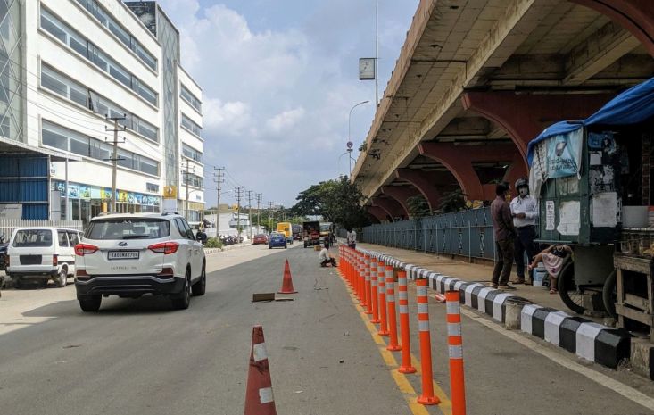
Last month I had posted about the BMTC installing cycle racks to the front of their buses. I had also mentioned that the BMTC and BBMP were setting up dedicated cycle lanes across the city including a pop-up cycle lane along Outer Ring Road next to the existing pop-up bus priority lane.
Thanks to Twitter user Nihar Thakkar (@Nihart1024), I got to see some of the work being done. Here are some images and videos of the cycle lanes.
For starters, here is a cycle parking stand under the split flyover at Agara Junction on Outer Ring Road.
This is on the Service Lane of ORR near the junction of the road bound for Whitefield. You can see the under-construction section of the Purple Line bound for Whitefield.
Sadly, BBMP is using plastic reflective bollards. These bollards are pretty flexible and can easily be damaged. Someone on a joyride in the middle of the night can just mow down these bollards. I do wish, more sturdy ones or even a fence similar to the one that NHAI uses to separate the service lanes from the main carriageway on Hosur Road was used.
Work is moving at a brisk pace on both the north and south bound lanes. Hopefully markings and signage is installed soon for an effective trial. pic.twitter.com/ZBzHqPjLd0
Since the Cycle Lanes are separated by bollards, the likelihood of people parking their cars on them is limited. Also, since they are on the right hand side of the service lane, it is on the side of the road where nobody would (hopefully) park. I sincerely hope that BBMP replaces any damaged or removed bollards to prevent cars from entering these lanes and also does something to prevent motorbikes from entering these lanes. I also hope the cycle lanes don’t disappear when the road is resurfaced (as it happened in Jayanagar) and that BBMP will maintain a uniform quality for the road surface.
That being said, I hope pedestrian infrastructure is next in the pipeline.
Waterloo Bridge – South Bank bus stop P where Transport for London (TfL) are trialling e-ink displays showing bus route information and live arrival information. Image copyright Chris McKenna, CC-BY-SA 4.0 International, available on the Wikimedia Commons.
My first experience with similar installations in India was in Bangalore at the Shanthinagar TTMC. There was a LED display with a wireless reception unit. It displayed the arrivals of Vayu Vajra buses towards the Airport in Kannada and English. This was followed by one in Mumbai along the Western Express Highway which displayed the ETAs of all buses in Marathi, and was pretty accurate. This was pretty much explained, in a previous post. In our transport-obsessed group, we have several discussions relating to buses and bus stops. During one of our conversations, we discussed a similar set-up at several bus stops along Mettupalayam Road in Coimbatore by the Corporation of Coimbatore for TNSTC buses.
A bus stop with a scrolling LED display in Coimbatore. Image copyright Srikanth Ramakrishnan, CC-BY-SA 3.0 Unported, available on the Wikimedia Commons.
This display, in Tamil shows the time, on the left, 05:37, which from the image metadata, I can gather is 05.37 in the evening, and the temperature 24°C. In between the two is the bus stop name: Vadakovai. The second line, which is scrolling, currently displays “Do not smoke here”. I’ve been told that it showed ETAs when it picked up an ETA. How this happened, however is a mystery. These displays appeared in 2012 and mysteriously vanished a year later.
Now, let us go deeper, and try and come up with an ideal ‘Smart Bus Stop’ shall we?
ACCESSIBILITY
An accessible bus stop in Paris. Image copyright jean-louis Zimmermann, CC 2.0 Generic, available on the Wikimedia Commons.
The most crucial aspect of a bus stop is accessibility. Even if the bus stop is just a unipole like the BEST bus stops in Mumbai, the area around the bus stop must be marked, tiled, and leveled for people who are differently-abled. Ramps must be provided for both wheelchair-bound passengers as well as those with motor disabilities.
LEVEL BOARDING
An example Level Boarding. Image copyright ByteOfKnowledge, CC-BY-SA 4.0 International, available on the Wikimedia Commons.
Level boarding refers to the level of the floor of the bus being at the same level as the platform, similar to Metro Rail and BRT systems.
The advantages of level boarding is simple: It allows people to board and disembark faster, therefore reducing crowds at the exits. In the case of a BRTS bus, the platform can be raised as the doors are on the right-hand side and thus there are no steps. However, to achieve this on regular buses and bus stops, which are normally at a foot’s height from the road level, a low-floor bus would be required.
DYNAMIC INFORMATION DISPLAY
A Bus Stop with a Display Unit at Christchurch. Image copyright Chris Downer, CC-BY-SA 2.0 Generic, available on Geograph/Wikimedia Commons.
All bus stops need to be able to display details of buses, their arrival, route, in a dynamic manner. Digital signage similar to what Transport for London or the Corporation of Coimbatore did. When this is possible for trains, why not buses? Why do people who are waiting at a bus stop have to rely on their instinct to know when the next bus is due? Why can’t they just look up at a board and see where the bus is going? It would be cheaper to set up Display Units to show when the next bus is expected, rather than asking users to lookup an app or send a text message.
EASE OF USE
A bus stop with a box for Visually-Impaired people to hear details of incoming buses at Sealife Centre. Image copyright Paul Gillet, CC-BY-SA 2.0 Generic, available on the Wikimedia Commons/Geograph.
While this deals with the same as Accessibility as discussed above, this deals with how a commuter uses the bus stop rather than gets to it. The bus stop should have a tactile path around it, as well as a device to announce the bus routes stopping there. It can have a panel with the route details embossed in Braille as well. If the system picks up a bus less than 100 metres away, it can automatically announce the number.
The Bottom Line
So here are what a smart bus-stop needs, assuming that the buses on the service are low-floor buses with a GPS-based tracking unit to broadcast their location.
Accessible for people with motor disabilities, differently-abled passengers, with a tactile path for the visually impaired.
Have an information display unit connected to a central network to show the arrivals of buses and their routes.
Announce route information, either based on availability [from GPS], or on request [by pressing a button].
Incorporate level boarding for buses to speed up the process of getting on or getting off a bus, as well as reduce the effort taken in doing so.
BEST Bus No. 56 at Versova Yari Road Bus Station. Image copyright Srikanth Ramakrishnan, CC-BY-SA 4.0 International, available on the Wikimedia Commons.
Public Information System / Intelligent Transport System
Now, I am going to start by introducing BEST’s Public Information System [PIS], also known as Intelligent Transit System [ITS], that I had attempted to explain in my post on Electronic Ticket Systems. As stated earlier, each bus stop in BEST is numbered. This number is used to identify the buses that stop at that particular bus stop and is used to determine the ETA of the buses that are arriving at that stop. This number also ensures that each stop is unique and in the database, so that the conductors can enter it on their ETMs. While, there may be two or more bus stops, adjacent to each other, sharing the same name, each bus stop caters to different buses and has a different Stop Code. However, for a particular bus, only one of those stops matters and thus, there is no confusion for the conductor as well.
In partnership with several firms, including Trimax IT, Verve Compusoft, Overtures Infotech, the BEST PIS is visible at its website http://bestpis.in.
Each bus is fitted with a set of GPS devices that are present above the drivers’ seat. This helps coordinating the location of the bus and transmitting the location to the server.
So, now:
At 9.10am on 8 September 2015, I sent BEST 07187 as an SMS to 56060.
I promptly got a response with the following:
NEHRU PLANETARIUM STOP : 003AS ETA 09:41,004AS ETA 09:41,033 ETA 09:44,305 ETA 09:48,592AS ETA 11:07,086 ETA 13:01,, Powered by Verve Compusoft Pvt. Ltd.
Here, 07187 is the stop code for the last Bus Stop towards Tardeo at Nehru Planetarium, where AS4 and A74Express stop. The response may be a bit confusing if it is the first time you are reading it, but here is what it means:
Nehru Planetarium is the name of the stop. The Expected Times of Arrival of the following buses are:
AS-3 at 9.41am
AS-4 at 9.41am
33 at 09.44am
305 at 09.48am
AS-592 at 11.07am
86 at 1.01pm.
Of course, do note that this doesn’t mean that the next 86 is going to come after 4 hours, it merely means that the next 86 with working GPS device is that far. It could also mean the system is faulty, since it was showing an ETA of 3.42am for AS-4 last night.
Now, BEST plans to integrate the existing system with a map that will show the exact position of the bus, live, on the map. While I personally feel this is a great move, BEST should also use this opportunity to ensure that all its buses are taken into consideration.
Stop Information System
This was something that started with the Jawaharlal Nehru National Urban Renewal Mission [JnNURM], now replaced with the Atal Mission for Rejuvination and Urban Transformation [AMRUT]. Under this, all buses were fitted with three exterior LED displays, one at the front of the bus, one on the side and one at the rear to display the route. While cities like Bangalore, Chennai and Mysore alternatively scrolled English and Kannada/Tamil on these displays, and Coimbatore showed only Tamil on all displays, BEST decided to have only Marathi on the front display, with English on the other two displays. A fourth LED display was present inside of the bus, behind the drivers area. This panel would display the upcoming stops, accompanied by an announcement. In most cases, they rarely work. They work in most of the older Blue-coloured JnNURM BMTC buses where they display the destination and the next stop. These systems work excellently in the Ahmedabad Janmarg as well as PMPML Rainbow. In BEST, I have experienced this only once, back in 2012, when I was in an AS-505 between Bandra Bus Station and CBD Belapur Bus Station. This system works with GPS too. However, it is nonfunctional on most BEST buses today, and needs to be revived soon.
Bus Identification System
Now this may come as a surprise to many, including my fellow BEST users, because it is not a very well known system. Some people may have seen it in a few buses that are part of Backbay Depot.
OnBoard Bus Identification System for Visually Impaired Passengers on a BEST Bus of the Backbay Depot. Image copyright Coolguyz.
This device is called OnBoard, and is jointly developed by the Xavier’s Resource Centre for Visually Challenged (XRCVC), in collaboration with Assistech of IIT-Delhi. It was tested first by BEST in two buses in February-April 2015 and then tested out in DTC. From what I gather, the system requires a visually impaired person to activate a switch which then informs them of any approaching bus. The box is fitted on the window frame next to the single seat up front. I believe this has scope to connect to the existing GPS set-up in order to make it automated, so when the bus reaches a stop, it gets triggered on its own. So, imagine if someone is waiting at World Trade Centre, for Bus No. 134. A bus fitted with OnBoard arrives, detects its location, or synchronises itself with the Bus Stop [a slightly expensive, difficult to maintain, but more efficient system] and it announces to the passenger: बस क्रमांक १३४: बॉकबे आगार ते प्रबोधनकार ठाकरे उद्यान शिवडी , followed by Bus Number 134, Backbay Depot to Prabodhankar Thakre Udyan Sewree. This would be great in my opinion.
This would be BESTs second attempt at trying improve accessibility for disabled passengers, with the previous one being the induction of the Ultra-Low-Floor Tata Starbus in 2004 with automatic doors and ramps for wheelchairs.
At the end of the day, BEST has done a good job at trying to do what it is supposed to do: Be a Transport Undertaking that caters to the Passengers, rather than try and rake in money, which is what NMMT , TMT, and mainly the BMTC seem to be doing. BEST was among the first transcos in India to reserve seats for women, senior citizens, physically-impaired commuters, and charge visually-impaired commuters a flat fare of ₹2 [earlier ₹1].
A smarter BEST, one that is able to cater to its commuters effectively, will most certainly help in making Mumbai a smarter city.